Lake Lanier Underwater Contour Maps: Difference between revisions
From WindsportAtlanta.com: Wiki
No edit summary |
No edit summary |
||
| Line 1: | Line 1: | ||
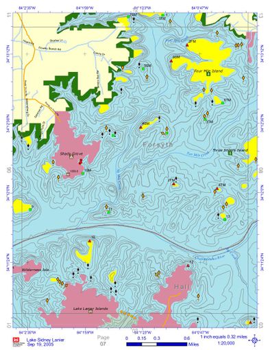
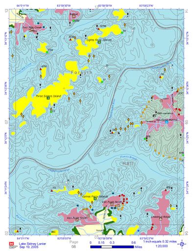
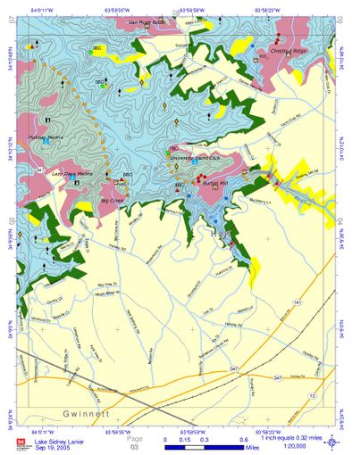
The maps are from the [ | The maps are from the [https://www.sam.usace.army.mil/Portals/46/docs/recreation/OP-SL/Maps/LakeLanierMapBook%202005-09-19.pdf Lake Lanier Map Book]. They show geographic contours, and unlike many such maps, include contours under water level. This is especially helpful when the lake is at lower levels as obstructions appear in what might otherwise appear to be very open water. Click on a map to see a larger version. Captions contain links to places within the map. | ||
<gallery widths=400px heights=510px perrow=2 caption="Lake Lanier Contour Maps" showfilename=1 > | <gallery widths=400px heights=510px perrow=2 caption="Lake Lanier Contour Maps" showfilename=1 > | ||
Revision as of 00:00, 12 June 2019
The maps are from the Lake Lanier Map Book. They show geographic contours, and unlike many such maps, include contours under water level. This is especially helpful when the lake is at lower levels as obstructions appear in what might otherwise appear to be very open water. Click on a map to see a larger version. Captions contain links to places within the map.
- Lake Lanier Contour Maps
West of Two Mile.jpg Two Mile Creek Park and Westward
Van Pugh Aqualand.jpg Van Pugh to Aqualand
Holiday VP South.jpg Van Pugh South to Holiday Harbor


